Gaos Kinematic Concept Limited is a wholly Nigerian, multidisciplinary consultancy firm established in 2015.
Founded by seasoned GIS specialists, geodesists and digital mappers, Gaos Kinematic Concept Limited provides high-precision surveying, geospatial intelligence, civil engineering and construction services. Our operations are guided by accuracy, innovation, safety and adherence to international professional standards.

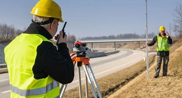
Cadastral, engineering, route, pipeline, deformation and topographic surveys using modern instruments and methods.

Digital mapping, land information systems, spatial analysis and geospatial decision-support solutions.
Design and construction of highways, drainage systems, bridges, culverts and critical infrastructure.

Geotechnical investigations, hydrographic surveys and offshore engineering support services.
Year Established
Permanent Professionals
Projects Successfully Delivered
Fresh field photographs showing the type of survey being carried out, the project location, and short site notes.
Tell us how we performed. Your review will be saved securely and also emailed to the company for quick attention.
Work with a trusted team of surveyors, engineers and GIS experts committed to excellence and precision.
Contact Us Today